Il-Ballut ta’ Marsaxlokk: New Archaeological Discoveries Beneath Malta’s Coast
A recent archaeological investigation carried out by the Superintendence of Cultural Heritage (SCH) at Il-Ballut ta’ Marsaxlokk has uncovered significant ancient remains and provided fresh insights into previously known archaeological features. Among the most notable discoveries is a rare fragment of a Greek louterion, dating back to the 6th or 5th century BCE, alongside a collection of ceramics, metal, and stone artefacts scattered across the seabed. The investigation also clarified the nature of a previously identified but unstudied structure, now confirmed to have been meticulously designed, indicating the presence of a wall.
The Significance of Il-Magħluq
Historically, Il-Magħluq has been linked to salt production, with its shallow waters clearly marked on 19th-century maps and depicted in early 20th-century photographs. The 1911 Ordnance Survey, however, referred to the area as “fishponds,” suggesting a more complex history that included aquaculture.
Moreover, the site is situated on the coast between Marsaxlokk Harbour and the Delimara Power Station within a region of considerable archaeological and historical importance.


Context of the Investigation
Prompted by a construction project proposed by the Environment and Resources Authority (ERA) to combat coastal erosion, the Superintendence of Cultural Heritage initiated this archaeological investigation which was intended to investigate the archaeologically sensitive area and guide the planning consultation process.
Upon initial review of the proposal, it was observed that the footprint of the proposed revetment and land reclamation intersects with areas containing recorded archaeological structures on the seabed, with significant effects on one of these key features, identified as Structure 3. Hence, the underwater archaeological investigation was specifically designed to focus on this structure and the surrounding sediments.

Key Archaeological Discoveries
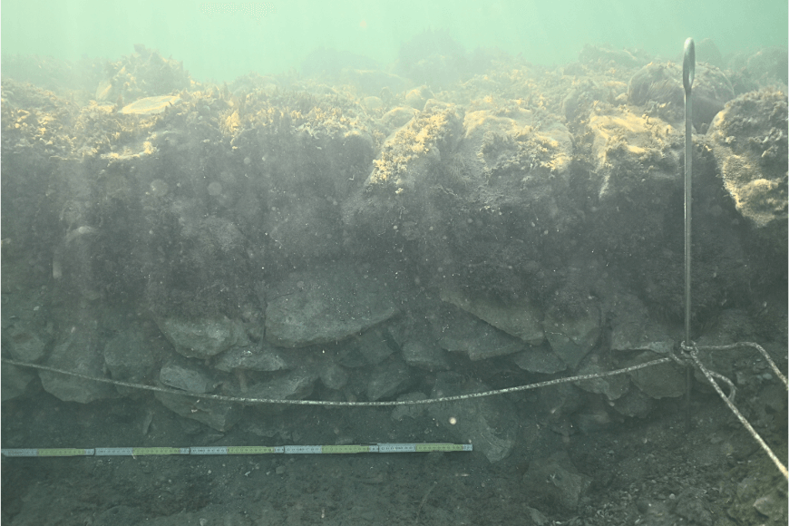
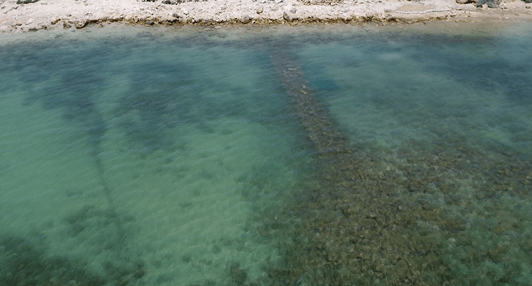
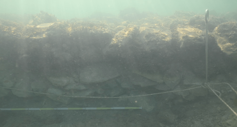
Structure 3, as detailed in a fieldwork report from the University of Malta, is a prominent underwater feature measuring 2 meters in width and 40 meters in length. This structure was the primary focus of the investigation, which involved excavating two trenches—Trench 1 and Trench 2—adjacent to it.
Excavation of Trench 2 revealed the full height of the structure, demonstrating that it was constructed with carefully stacked limestone rubble rather than haphazardly dumped. Although the structure is predated by the artefacts found beneath it, determining its exact date remains challenging and further investigation is needed.
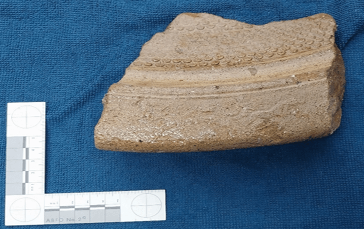
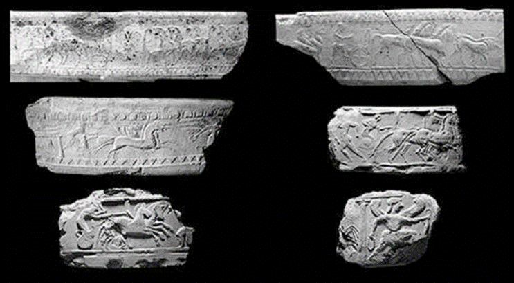
The excavations uncovered a remarkable collection of artefacts, with one of the most significant being a fragment of a louterion, a decorative basin used in ancient Greek rituals. This fragment, originally part of a basin measuring 70 cm in diameter, is adorned with intricate designs, including horse-drawn chariots along the rim. Dating back to the 6th or 5th centuries BCE, the louterion was typically used for holding water for bathing or ritual washing and was often mounted on a pedestal. While louteria are emblematic of the Greek Late Archaic period, similar vessels were adapted by indigenous cultures in the Central Mediterranean. Comparable examples from Sicily, dating to the same period, have been described by A. Ward (2018) and are illustrated below.
Artefacts and Significance
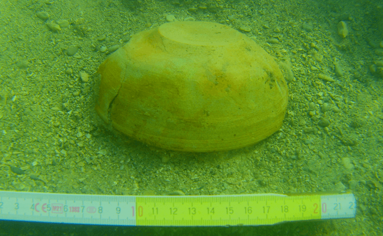
More than 64 artefacts were recovered during the excavations, including pottery, faunal remains, and metal objects. The louterion fragment, adorned with images of horse-drawn chariots, stands out as one of the most notable finds. Other notable discoveries include an almost complete bowl, faunal remains, and various ceramics, all of which are currently being conserved and analysed.
The concentration of material in a small, specific area highlights the site’s exceptional archaeological sensitivity, necessitating both stringent protective measures and further investigation. Although some material may have been displaced through wave action, the depth at which the materials were found suggests that they were discovered in their primary context i.e. they were discarded or deposited in the same location where they were discovered.
Conservation and Protection Efforts
The Environment and Resources Authority (ERA) has filed a Planning Application (PA01484/24) to protect the area from further coastal erosion by constructing a rock boulder revetment and public walkway. While this project is vital for safeguarding the wetland at Il-Ballut ta’ Marsaxlokk, it poses challenges for the preservation of the underwater archaeological features.
To mitigate potential damage during construction, the Superintendence of Cultural Heritage has made several recommendations, including continuous archaeological monitoring intended to safeguard the submerged structures against inadvertent harm.
As excavation and conservation efforts continue, it is clear that Il-Ballut ta’ Marsaxlokk will play a crucial role in uncovering fragments of Malta’s maritime history. The site’s archaeological potential is immense, and further studies will likely reveal more about its significance to Maltese national heritage.
References
Ward, Andrew. (2018). Modelling Regional Networks and Local Adaptation: West-Central Sicilian Relief Louteria. Les Carnets de l’ACoSt. 17. 10.4000/acost.1107.

